Red Rocks - Southwest trip, 2012
GRAND STAIRCASE ESCALANTE
National
Monument, Utah
Grand Staircase Escalante
| We spent two nights in Torrey, Utah . Torrey is a tiny town - tinier than it already used to be after Bain Capital under Mr. Romney's leadership bought and closed the only sizeable company in town. Today, according to its web page the town has 171 inhabitants, most of whom I suspect are either retired or living of tourists like us. We decided to spend two nights here because (a) because it was the most sensible stopping point between Moab and Springfield if we wanted to vsit both Natural Bridges and Capitol Reef on the way and (b) because we had read vey good things about Skyridge Inn and the Cafe Diablo where we were promised a gourmet dining experience. When you are travelling in the wilds of practically nowhere, you do not skip an opportunity like that! We enjoyed our stay at the Skyridge Inn very much and can recommend it. The Cafe Diablo was ok, but I am not sure it was worth the hype or the price. But then again, it is in the back of beyond, Utah. From that point of view - not bad. | ||||
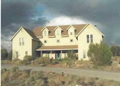
Skyridge Inn |
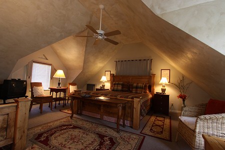
Our room at the inn |
View from the inn of Capitol Reef |
||
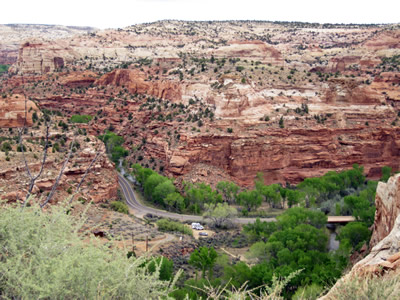
| Grand Staircase Escalante covers a huge amount of territory from Capitol Reef to the Grand Canyon. Most of it, however, is wilderness requiring back-country permits for hiking and camping. Obviously not for us. However, the map showed an interesting looking backroad leading to Bryce National Park and so we decided to explore the area as much as possible by car and headed out on State Route 12. It started out sedately enough, but pretty soon we were heading up into the mountains and climbing a, let's say interesting pass road. As we climbed up to 9,300 feet | ||||
|
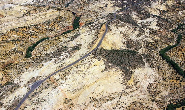
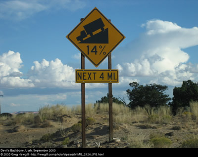
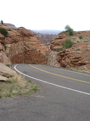
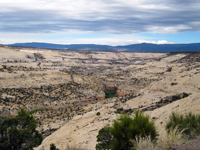
"Between Calf Creek Recreation Area and Boulder Town is an internationally famous stretch of byway known as “The Hogback.” "As the asphalt clings to this thin razorback ridge of slickrock, the terrain spills steeply off to each side toward winding creeks and canyons below, where cottonwoods provide ribbons of green, gold, or gray depending on the season. Driving here is slow and cautious, but the vistas are incredible." ( hogback webpage)And I have now found a very good video of a drive on the hogback: http://www.youtube.com/watch?v=xpzA-rzKX50&noredirect=1 Definitely worth watching! |
we appreciated the fantastic views, but also the fact that this road is referred to not only as a "scenic byway" but also as the "devil's backbone" and up at the top is what is referred to as the "Hogback". The quote on the right does spell it out: thin ridge - steep declines on either side - NO ROOM FOR MISTAKES! - we drove at a time when there was no traffic - April, before the serious tourist season starts. Route 12 between Torrey and Panguitch is 124 miles, but it is the stretch between Torrey and Escalante that provides the excitement. It is only 65 miles, but with pratically no traffic and a car that is built for mountain driving it took us a good two and a half hours. In the meantime I have read that it normally takes between four and six hours - so, our time was not bad at all! | |||
Scenic State Route 12 - well, you go up and then you must come down! |
 |
|||
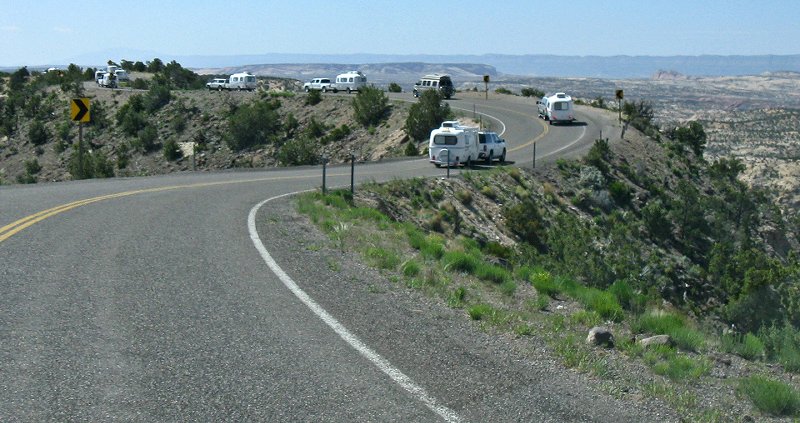
| The Devils Backbone - a challenge to drive, but beautiful sights to see. The picture above shows what it looks like during the heavy travel season and I do not wish to contemplate how long it takes when one is crawling behind the SUVs and campers. | ||||
 |
 |
 |
||
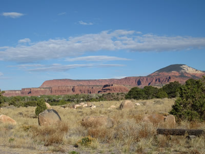
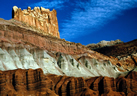
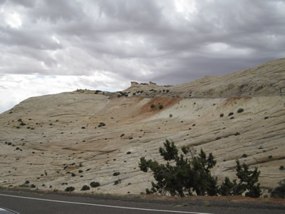
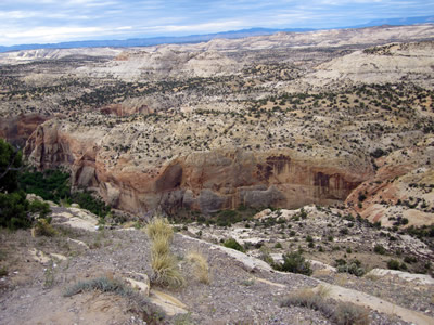
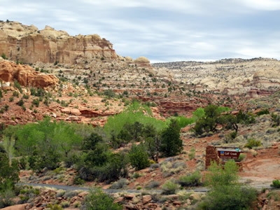
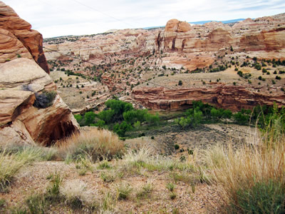
| Grand Staircase Escalante - Above and Below some of the pictures showing the scenery from the road. | ||||
 |
 |
 |
||
| Cowards that we are, we drove back through Panguitch and the next morning we left Torrey to visit Bryce Canyon and then on to our last stop - | ||||
 |
Springville and Zion National Park. This time we took a different "scenic route" State Rt. 22. It did not climb to the breathtaking heights as the Devil's backbone, but it is such a lonely, little travelled road that at times it becomes so narrow and poorly maintained that one wonders if it really will join with Rt 112 just before Bryce Canyon. The picture of the abandoned grain mill on the right shows on of the very, very few structures on this stretch and its condition, as well as the picture on the left, does | 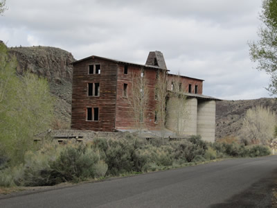 |
||
| give an idea of how populated the area is. But I am happy to report, the road does work (still) and is actually a shortcut to get to Bryce Canyon from Torrey. We were nearing the end of our trip, but in this part of world there is always another surprise just around the corner. | ||||