
Resources
LOC: Introduction to the Sanborn Collection
Some background and introduction to the Sanborn Map Collection at the Library of Congress.
LOC: About the Sanborn Collection
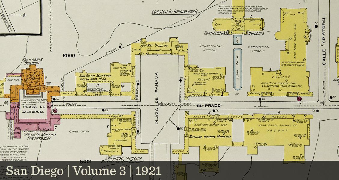
Guidelines for accessing and using the Sanborn Map Collection at the Library of Congress. Includes detailed guidelines on interpreting keys, legends, colors, symbology and indexes.
A glossary of abbreviations and obscure terminology found within Sanborn map sheets.
Union List of Sanborn & Other Fire Insurance Maps
Hosted by the UC Berkeley Earth Sciences & Map Library and compiled by Philip Hoehn, this comprehensive list catalogs coverage areas, dates and owning institutions for Sanborn maps housed throughout North America. Also check out their History of Sanborn Fire Insurance Maps.
Hosted by Historical Information Gatherers, this site offers “educational and support materials for use and understanding of Sanborn Maps”.
Sanborn Fire Insurance Atlases at LAPL
Background and instructions for using online Sanborn Fire Insurance Atlases at the Central Library.
Los Angeles County Sanborn Maps at CSUN
An online finding aid for locating CSUN Sanborn volumes within Los Angeles County.
Articles and Other Links
Historical Atlases Rescued from the Trash
From Greg Miller at All Over the Map, some backstory on how CSUN came to acquire its collection of Sanborn atlases.
From Ann Schmidt at The Daily Mail, some additional backstory on how the CSUN Sanborn Collection came about.