Kashi Basin Research
links
 |
||
|---|---|---|
The southern Tian Shan foreland basin.
The Tian Shan in central Asia are the highest mountain range outside of the Himalaya and accommodate up to 40% (~20 mm/yr) of the total convergence between India and Eurasia, but the spatial pattern of deformation, the initiation of uplift, and how climatic shifts during the Cenozoic have affected sedimentation and erosion in the region remains controversial. Geologic mapping, magnetostratigraphy, sedimentary and structural analysis, and differential GPS surveys were combined to quantify the sedimentary and structural evolution of the southwestern Tian Shan foreland since 25 Ma. More than 6500 square kilometers of the foreland were mapped and 15 stratigraphic sections measured. Our thorough magnetostratigraphy from the region makes this arguably the best-dated foreland in the world and provides new age-control on strata and growth structures. Overall, our data from the Kashi Basin imply that orogens grow in pulsed episodes and that tectonics, in some cases, is a primary control on the stratigraphic architecture. |
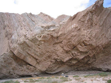
Syncline in Wuqia group strata. |
|
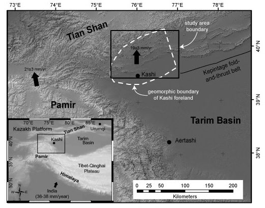 |
Shortening rates based on GPS data indicate that ~20 mm/yr is accomodated in the western Tian Shan, of which ~8 mm/yr is taken up in the Kashi foreland basin in W. China. | |
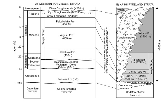
Correlation of Kashi Basin stratigraphy with the existing Tarim basin nomenclature (Heermance et al., 2007). |
 |
|
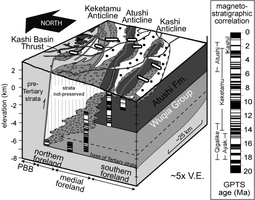 |
Schematic
geometry of the Kashi basin stratigraphy showing magnetostratigraphic
correlation of the composite measured sections. Late Tertiary
deposition occurred between 18 and 0 Ma. The ubiquitous Xiyu
conglomerate, formerly considered a Plio-Pleistocene formation
indicative of a global climate shift, is instead a time-transgressive,
syn-tectonic formation that spans from 15.5 Ma in the northern basin to
<1 Ma in the southern basin (Heermance et al.,
2007). Progradation of the Xiyu conglomerate is controlled
by basinward migration of structures, and faster progradation rates
correlate at with times of higher shortening rates. |
|
| Growth strata and sedimentation rate changes are interpreted to represent the initiation of structural deformation at specific locations. | 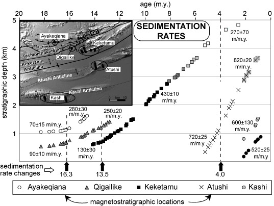 |
|
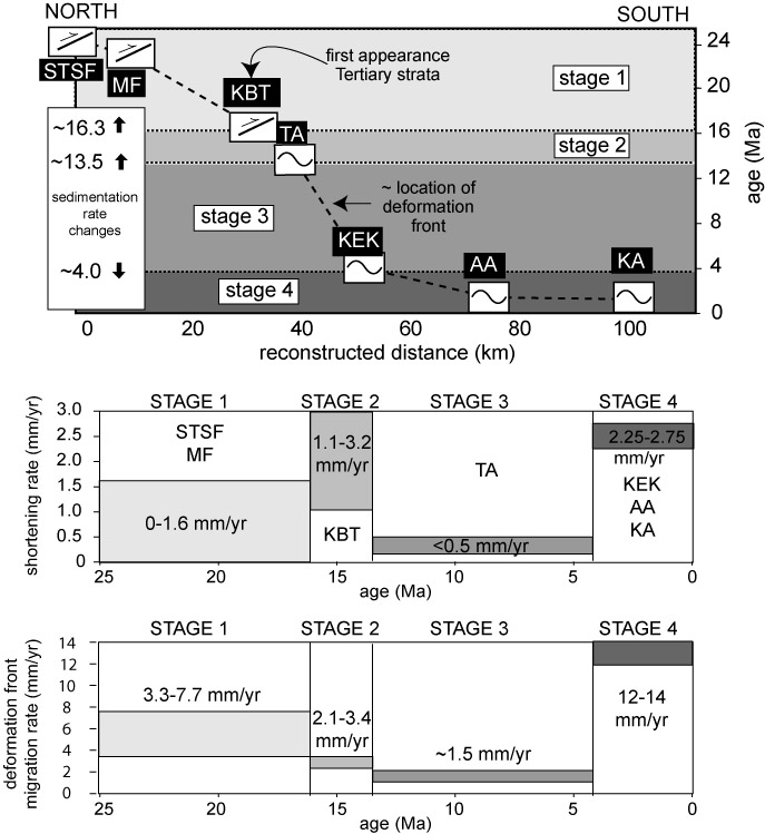 |
At least four distinct stages of deformation occurred since the initiation of range uplift between 20 and 25 Ma, with variable shortening rates between 0.5-3 mm/yr (Heermance et al., in review). All geologic rates are less than the 8 mm/year expected from GPS measurements alone, and suggest that deformation may migrate into and out-of the basin in pulsed episodes. | |
